
Indonesia steps up efforts to curb cross-border haze
Deputy for Meteorology at the BMKG Guswanto informed that the system utilises data from several sources, including the National Oceanic and Atmospheric Administration (NOAA), to produce fire risk maps marked with green, orange, and red indicators, meaning relatively safe, high potential and active fires, respectively.
The Indonesian Government, through the Meteorology, Climatology, and Geophysics Agency (BMKG), is optimising the use of the fire danger rating system (FDRS) for the early detection of forest and land fires to support firefighting efforts.
Deputy for Meteorology at the BMKG Guswanto informed that the system utilises data from several sources, including the National Oceanic and Atmospheric Administration (NOAA), to produce fire risk maps marked with green, orange, and red indicators, meaning relatively safe, high potential and active fires, respectively.
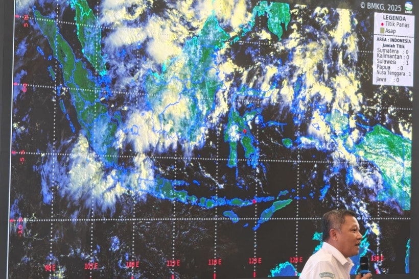
The BMKG meteorology team is using the FDRS, combined with satellite images, to monitor smoke distribution, wind direction, and potential cross-border haze. They also combine hotspot data with field monitoring by the Manggala Agni ground firefighting unit of the Ministry of Forestry and the aerial fleet of the National Disaster Management Agency (BNPB).
Guswanto noted that the system had proven effective in identifying daily priority areas for tackling forest and land fires.
He stressed that prevention and early detection are far more effective than handling fires after they spread. With the FDRS, the risks of environmental and health damage from forest and land fires can be reduced during the dry season, which is expected to end in September 2025./.